Lijst van gemeenten in Noord-Brabant: verschil tussen versies
Naar navigatie springen
Naar zoeken springen
(Verbouwing van het gemeentehuis van Altena is nu nog bezig (?), gemeentehuis van Woudrichum wordt nu gebruikt. Dit is alvast de nieuwe.) |
k (Link naar doorverwijspagina Boekel gewijzigd in Boekel (gemeente); gewijzigd in Boekel (gemeente) met DisamAssist) |
||
| (14 tussenliggende versies door 4 gebruikers niet weergegeven) | |||
| Regel 1: | Regel 1: | ||
| − | |||
Hieronder vindt je een '''lijst van alle gemeenten in de [[Nederland]]se provincie [[Noord-Brabant]]'''. Hierbij staan de naam, ligging (kaartje) en inwonersaantal vermeld. In 2018 is deze lijst voor het laatst bijgewerkt. | Hieronder vindt je een '''lijst van alle gemeenten in de [[Nederland]]se provincie [[Noord-Brabant]]'''. Hierbij staan de naam, ligging (kaartje) en inwonersaantal vermeld. In 2018 is deze lijst voor het laatst bijgewerkt. | ||
{| class="wikitable" | {| class="wikitable" | ||
| Regel 21: | Regel 20: | ||
| 93,02 | | 93,02 | ||
| [[Alphen (Noord-Brabant)|Alphen]] | | [[Alphen (Noord-Brabant)|Alphen]] | ||
| − | | [[ | + | | [[Bestand:NL_-_locator_map_municipality_code_GM1723_(2016).png|300px]] |
|- | |- | ||
| 3 | | 3 | ||
| Regel 28: | Regel 27: | ||
| 70,21 | | 70,21 | ||
| [[Asten]] | | [[Asten]] | ||
| − | | [[ | + | | [[Bestand:NL_-_locator_map_municipality_code_GM0743_(2016).png|300px]] |
|- | |- | ||
| 4 | | 4 | ||
| Regel 35: | Regel 34: | ||
| 76,16 | | 76,16 | ||
| [[Baarle-Nassau]] | | [[Baarle-Nassau]] | ||
| − | | [[ | + | | [[Bestand:NL_-_locator_map_municipality_code_GM0744_(2016).png|300px]] |
|- | |- | ||
| 5 | | 5 | ||
| Regel 42: | Regel 41: | ||
| 101,18 | | 101,18 | ||
| [[Bergeijk]] | | [[Bergeijk]] | ||
| − | | [[ | + | | [[Bestand:NL_-_locator_map_municipality_code_GM1724_(2016).png|300px]] |
|- | |- | ||
| 6 | | 6 | ||
| Regel 49: | Regel 48: | ||
| 80,04 | | 80,04 | ||
| [[Bergen op Zoom]] | | [[Bergen op Zoom]] | ||
| − | | [[ | + | | [[Bestand:NL_-_locator_map_municipality_code_GM0748_(2016).png|300px]] |
|- | |- | ||
| 7 | | 7 | ||
| Regel 56: | Regel 55: | ||
| 89,75 | | 89,75 | ||
| [[Heesch]] | | [[Heesch]] | ||
| − | | [[ | + | | [[Bestand:NL_-_locator_map_municipality_code_GM1721_(2016).png|300px]] |
|- | |- | ||
| 8 | | 8 | ||
| Regel 63: | Regel 62: | ||
| 34,31 | | 34,31 | ||
| [[Best]] | | [[Best]] | ||
| − | | [[ | + | | [[Bestand:NL_-_locator_map_municipality_code_GM0753_(2016).png|300px]] |
|- | |- | ||
| 9 | | 9 | ||
| Regel 70: | Regel 69: | ||
| 75,35 | | 75,35 | ||
| [[Bladel]] | | [[Bladel]] | ||
| − | | [[ | + | | [[Bestand:NL_-_locator_map_municipality_code_GM1728_(2016).png|300px]] |
|- | |- | ||
| 10 | | 10 | ||
| − | | [[Boekel]] | + | | [[Boekel (gemeente)|Boekel]] |
| 10.543 | | 10.543 | ||
| 34,51 | | 34,51 | ||
| − | | [[Boekel]] | + | | [[Boekel (gemeente)|Boekel]] |
| − | | [[ | + | | [[Bestand:NL_-_locator_map_municipality_code_GM0755_(2016).png|300px]] |
|- | |- | ||
| 11 | | 11 | ||
| Regel 84: | Regel 83: | ||
| 111,51 | | 111,51 | ||
| [[Boxmeer]] | | [[Boxmeer]] | ||
| − | | [[ | + | | [[Bestand:NL_-_locator_map_municipality_code_GM0756_(2016).png|300px]] |
|- | |- | ||
| 12 | | 12 | ||
| Regel 91: | Regel 90: | ||
| 63,75 | | 63,75 | ||
| [[Boxtel]] | | [[Boxtel]] | ||
| − | | [[ | + | | [[Bestand:NL_-_locator_map_municipality_code_GM0757_(2016).png|300px]] |
|- | |- | ||
| 13 | | 13 | ||
| Regel 98: | Regel 97: | ||
| 126,04 | | 126,04 | ||
| [[Breda]] | | [[Breda]] | ||
| − | | [[ | + | | [[Bestand:NL_-_locator_map_municipality_code_GM0758_(2016).png|300px]] |
|- | |- | ||
| 14 | | 14 | ||
| Regel 105: | Regel 104: | ||
| 76,45 | | 76,45 | ||
| [[Budel]] | | [[Budel]] | ||
| − | | [[ | + | | [[Bestand:NL_-_locator_map_municipality_code_GM1706_(2016).png|300px]] |
|- | |- | ||
| 15 | | 15 | ||
| Regel 112: | Regel 111: | ||
| 51,29 | | 51,29 | ||
| [[Cuijk]] | | [[Cuijk]] | ||
| − | | [[ | + | | [[Bestand:NL_-_locator_map_municipality_code_GM1684_(2016).png|300px]] |
|- | |- | ||
| 16 | | 16 | ||
| − | | [[Deurne]] | + | | [[Deurne (gemeente)|Deurne]] |
| 32.177 | | 32.177 | ||
| 117,03 | | 117,03 | ||
| − | | [[Deurne]] | + | | [[Deurne (gemeente)|Deurne]] |
| + | | [[Bestand:NL_-_locator_map_municipality_code_GM0762_(2016).png|300px]] | ||
|- | |- | ||
| 17 | | 17 | ||
| Regel 125: | Regel 125: | ||
| 29,29 | | 29,29 | ||
| [[Dongen]] | | [[Dongen]] | ||
| + | | [[Bestand:NL_-_locator_map_municipality_code_GM0766_(2016).png|300px]] | ||
|- | |- | ||
| 18 | | 18 | ||
| Regel 131: | Regel 132: | ||
| 96,13 | | 96,13 | ||
| [[Made (Noord-Brabant)|Made]] | | [[Made (Noord-Brabant)|Made]] | ||
| + | | [[Bestand:NL_-_locator_map_municipality_code_GM1719_(2016).png|300px]] | ||
|- | |- | ||
| 19 | | 19 | ||
| Regel 137: | Regel 139: | ||
| 82,47 | | 82,47 | ||
| [[Eersel]] | | [[Eersel]] | ||
| + | | [[Bestand:NL_-_locator_map_municipality_code_GM0770_(2016).png|300px]] | ||
|- | |- | ||
| 20 | | 20 | ||
| Regel 143: | Regel 146: | ||
| 87,72 | | 87,72 | ||
| [[Eindhoven]] | | [[Eindhoven]] | ||
| + | | [[Bestand:NL_-_locator_map_municipality_code_GM0772_(2016).png|300px]] | ||
|- | |- | ||
| 21 | | 21 | ||
| Regel 149: | Regel 153: | ||
| 55,36 | | 55,36 | ||
| [[Etten-Leur]] | | [[Etten-Leur]] | ||
| + | | [[Bestand:NL_-_locator_map_municipality_code_GM0777_(2016).png|300px]] | ||
|- | |- | ||
| 22 | | 22 | ||
| − | | [[Geertruidenberg]] | + | | [[Geertruidenberg (gemeente)|Geertruidenberg]] |
| 21.504 | | 21.504 | ||
| 26,64 | | 26,64 | ||
| − | | [[Geertruidenberg]] | + | | [[Geertruidenberg (plaats)|Geertruidenberg]] |
| + | | [[Bestand:NL_-_locator_map_municipality_code_GM0779_(2016).png|300px]] | ||
|- | |- | ||
| 23 | | 23 | ||
| Regel 161: | Regel 167: | ||
| 31,02 | | 31,02 | ||
| [[Geldrop]] | | [[Geldrop]] | ||
| + | | [[Bestand:NL_-_locator_map_municipality_code_GM1771_(2016).png|300px]] | ||
|- | |- | ||
| 24 | | 24 | ||
| Regel 167: | Regel 174: | ||
| 122,53 | | 122,53 | ||
| [[Gemert]] en [[Bakel]] | | [[Gemert]] en [[Bakel]] | ||
| + | | [[Bestand:NL_-_locator_map_municipality_code_GM1652_(2016).png|300px]] | ||
|- | |- | ||
| 25 | | 25 | ||
| Regel 173: | Regel 181: | ||
| 65,49 | | 65,49 | ||
| [[Rijen]] | | [[Rijen]] | ||
| + | | [[Bestand:NL_-_locator_map_municipality_code_GM0784_(2016).png|300px]] | ||
|- | |- | ||
| 26 | | 26 | ||
| Regel 179: | Regel 188: | ||
| 42,07 | | 42,07 | ||
| [[Goirle]] | | [[Goirle]] | ||
| + | | [[Bestand:NL_-_locator_map_municipality_code_GM0785_(2016).png|300px]] | ||
|- | |- | ||
| 27 | | 27 | ||
| − | | [[Grave]] | + | | [[Grave (plaats)|Grave]] |
| 12.416 | | 12.416 | ||
| 27,18 | | 27,18 | ||
| − | | [[Grave]] | + | | [[Grave (plaats)|Grave]] |
| + | | [[Bestand:NL_-_locator_map_municipality_code_GM0786_(2016).png|300px]] | ||
|- | |- | ||
| 28 | | 28 | ||
| − | |||
| − | |||
| − | |||
| − | |||
| − | |||
| − | |||
| [[Halderberge]] | | [[Halderberge]] | ||
| 29.894 | | 29.894 | ||
| 74,56 | | 74,56 | ||
| [[Oudenbosch]] | | [[Oudenbosch]] | ||
| + | | [[Bestand:NL_-_locator_map_municipality_code_GM1655_(2016).png|300px]] | ||
|- | |- | ||
| − | | | + | | 29 |
| [[Heeze-Leende]] | | [[Heeze-Leende]] | ||
| 15.911 | | 15.911 | ||
| 104,00 | | 104,00 | ||
| [[Heeze]] | | [[Heeze]] | ||
| + | | [[Bestand:NL_-_locator_map_municipality_code_GM1658_(2016).png|300px]] | ||
|- | |- | ||
| − | | | + | | 30 |
| [[Helmond]] | | [[Helmond]] | ||
| 91.024 | | 91.024 | ||
| 53,23 | | 53,23 | ||
| [[Helmond]] | | [[Helmond]] | ||
| + | | [[Bestand:NL_-_locator_map_municipality_code_GM0794_(2016).png|300px]] | ||
|- | |- | ||
| − | | | + | | 31 |
| − | | [['s-Hertogenbosch]] <br>(Den Bosch) | + | | [['s-Hertogenbosch]] <br />(Den Bosch) |
| 153.434 | | 153.434 | ||
| 84,45 | | 84,45 | ||
| [['s-Hertogenbosch]] | | [['s-Hertogenbosch]] | ||
| + | | [[Bestand:NL_-_locator_map_municipality_code_GM0796_(2016).png|300px]] | ||
|- | |- | ||
| − | | | + | | 32 |
| − | | [[Heusden]] | + | | [[Heusden (Noord-Brabant)|Heusden]] |
| 43.756 | | 43.756 | ||
| 78,87 | | 78,87 | ||
| [[Vlijmen]] | | [[Vlijmen]] | ||
| + | | [[Bestand:NL_-_locator_map_municipality_code_GM0797_(2016).png|300px]] | ||
|- | |- | ||
| − | | | + | | 33 |
| [[Hilvarenbeek]] | | [[Hilvarenbeek]] | ||
| 15.350 | | 15.350 | ||
| 94,93 | | 94,93 | ||
| [[Hilvarenbeek]] | | [[Hilvarenbeek]] | ||
| + | | [[Bestand:NL_-_locator_map_municipality_code_GM0798_(2016).png|300px]] | ||
|- | |- | ||
| − | | | + | | 34 |
| [[Laarbeek]] | | [[Laarbeek]] | ||
| 22.206 | | 22.206 | ||
| 55,37 | | 55,37 | ||
| [[Beek en Donk]] | | [[Beek en Donk]] | ||
| + | | [[Bestand:NL_-_locator_map_municipality_code_GM1659_(2016).png|300px]] | ||
|- | |- | ||
| − | | | + | | 35 |
| [[Landerd]] | | [[Landerd]] | ||
| 15.440 | | 15.440 | ||
| 70,38 | | 70,38 | ||
| [[Schaijk]] en [[Zeeland (Noord-Brabant)|Zeeland]] | | [[Schaijk]] en [[Zeeland (Noord-Brabant)|Zeeland]] | ||
| + | | [[Bestand:NL_-_locator_map_municipality_code_GM1685_(2016).png|300px]] | ||
|- | |- | ||
| − | | | + | | 36 |
| [[Loon op Zand]] | | [[Loon op Zand]] | ||
| 23.191 | | 23.191 | ||
| 50,15 | | 50,15 | ||
| [[Kaatsheuvel]] | | [[Kaatsheuvel]] | ||
| + | | [[Bestand:NL_-_locator_map_municipality_code_GM0809_(2016).png|300px]] | ||
|- | |- | ||
| − | | | + | | 37 |
| [[Meierijstad]] | | [[Meierijstad]] | ||
| 80.500 | | 80.500 | ||
| 184,10 | | 184,10 | ||
| [[Veghel]] | | [[Veghel]] | ||
| + | | | ||
|- | |- | ||
| − | | | + | | 38 |
| [[Mill en Sint Hubert]] | | [[Mill en Sint Hubert]] | ||
| 10.821 | | 10.821 | ||
| 52,28 | | 52,28 | ||
| [[Mill]] | | [[Mill]] | ||
| + | | [[Bestand:NL_-_locator_map_municipality_code_GM0815_(2016).png|300px]] | ||
|- | |- | ||
| − | | | + | | 39 |
| − | | [[Moerdijk]] | + | | [[Moerdijk (Nederland)|Moerdijk]] |
| 36.933 | | 36.933 | ||
| 159,24 | | 159,24 | ||
| [[Zevenbergen (Moerdijk)|Zevenbergen]] | | [[Zevenbergen (Moerdijk)|Zevenbergen]] | ||
| + | | [[Bestand:NL_-_locator_map_municipality_code_GM1709_(2016).png|300px]] | ||
|- | |- | ||
| − | | | + | | 40 |
| [[Nuenen, Gerwen en Nederwetten]] | | [[Nuenen, Gerwen en Nederwetten]] | ||
| 23.060 | | 23.060 | ||
| 33,72 | | 33,72 | ||
| [[Nuenen]] | | [[Nuenen]] | ||
| + | | [[Bestand:NL_-_locator_map_municipality_code_GM0820_(2016).png|300px]] | ||
|- | |- | ||
| − | | | + | | 41 |
| [[Oirschot]] | | [[Oirschot]] | ||
| 18.580 | | 18.580 | ||
| 101,78 | | 101,78 | ||
| [[Oirschot]] | | [[Oirschot]] | ||
| + | | [[Bestand:NL_-_locator_map_municipality_code_GM0823_(2016).png|300px]] | ||
|- | |- | ||
| − | | | + | | 42 |
| [[Oisterwijk]] | | [[Oisterwijk]] | ||
| 26.162 | | 26.162 | ||
| 63,93 | | 63,93 | ||
| [[Oisterwijk]] | | [[Oisterwijk]] | ||
| + | | [[Bestand:NL_-_locator_map_municipality_code_GM0824_(2016).png|300px]] | ||
|- | |- | ||
| − | | | + | | 43 |
| [[Oosterhout]] | | [[Oosterhout]] | ||
| 55.286 | | 55.286 | ||
| 71,47 | | 71,47 | ||
| [[Oosterhout]] | | [[Oosterhout]] | ||
| + | | [[Bestand:NL_-_locator_map_municipality_code_GM0826_(2016).png|300px]] | ||
|- | |- | ||
| − | | | + | | 44 |
| [[Oss]] | | [[Oss]] | ||
| 91.057 | | 91.057 | ||
| 152,42 | | 152,42 | ||
| [[Oss]] | | [[Oss]] | ||
| + | | [[Bestand:NL_-_locator_map_municipality_code_GM0828_(2016).png|300px]] | ||
|- | |- | ||
| − | | | + | | 45 |
| [[Reusel-De Mierden]] | | [[Reusel-De Mierden]] | ||
| 13.011 | | 13.011 | ||
| 77,93 | | 77,93 | ||
| [[Reusel]] | | [[Reusel]] | ||
| + | | [[Bestand:NL_-_locator_map_municipality_code_GM1667_(2016).png|300px]] | ||
|- | |- | ||
| − | | | + | | 46 |
| [[Roosendaal]] | | [[Roosendaal]] | ||
| 76.964 | | 76.964 | ||
| 106,42 | | 106,42 | ||
| [[Roosendaal]] | | [[Roosendaal]] | ||
| + | | [[Bestand:NL_-_locator_map_municipality_code_GM1674_(2016).png|300px]] | ||
|- | |- | ||
| − | | | + | | 47 |
| [[Rucphen]] | | [[Rucphen]] | ||
| 22.475 | | 22.475 | ||
| 64,41 | | 64,41 | ||
| [[Rucphen]] | | [[Rucphen]] | ||
| + | | [[Bestand:NL_-_locator_map_municipality_code_GM0840_(2016).png|300px]] | ||
|- | |- | ||
| − | | | + | | 48 |
| [[Sint Anthonis]] | | [[Sint Anthonis]] | ||
| 11.585 | | 11.585 | ||
| 99,26 | | 99,26 | ||
| [[Sint Anthonis]] | | [[Sint Anthonis]] | ||
| + | | [[Bestand:NL_-_locator_map_municipality_code_GM1702_(2016).png|300px]] | ||
|- | |- | ||
| − | | | + | | 49 |
| [[Sint-Michielsgestel]] | | [[Sint-Michielsgestel]] | ||
| 28.781 | | 28.781 | ||
| 58,44 | | 58,44 | ||
| [[Sint-Michielsgestel]] | | [[Sint-Michielsgestel]] | ||
| + | | [[Bestand:NL_-_locator_map_municipality_code_GM0845_(2016).png|300px]] | ||
|- | |- | ||
| − | | | + | | 50 |
| [[Someren]] | | [[Someren]] | ||
| 19.227 | | 19.227 | ||
| 80,30 | | 80,30 | ||
| [[Someren]] | | [[Someren]] | ||
| + | | [[Bestand:NL_-_locator_map_municipality_code_GM0847_(2016).png|300px]] | ||
|- | |- | ||
| − | | | + | | 51 |
| [[Son en Breugel]] | | [[Son en Breugel]] | ||
| 16.739 | | 16.739 | ||
| 25,95 | | 25,95 | ||
| [[Son (Son en Breugel)|Son]] | | [[Son (Son en Breugel)|Son]] | ||
| + | | [[Bestand:NL_-_locator_map_municipality_code_GM0848_(2016).png|300px]] | ||
|- | |- | ||
| − | | | + | | 52 |
| [[Steenbergen]] | | [[Steenbergen]] | ||
| 25.387 | | 25.387 | ||
| 146,66 | | 146,66 | ||
| [[Steenbergen]] | | [[Steenbergen]] | ||
| + | | [[Bestand:NL_-_locator_map_municipality_code_GM0851_(2016).png|300px]] | ||
|- | |- | ||
| − | | | + | | 53 |
| [[Tilburg]] | | [[Tilburg]] | ||
| 215.946 | | 215.946 | ||
| 117,29 | | 117,29 | ||
| [[Tilburg]] | | [[Tilburg]] | ||
| + | | [[Bestand:NL_-_locator_map_municipality_code_GM0855_(2016).png|300px]] | ||
|- | |- | ||
| − | | | + | | 54 |
| [[Uden]] | | [[Uden]] | ||
| 41.748 | | 41.748 | ||
| 67,05 | | 67,05 | ||
| [[Uden]] | | [[Uden]] | ||
| + | | [[Bestand:NL_-_locator_map_municipality_code_GM0856_(2016).png|300px]] | ||
|- | |- | ||
| − | | | + | | 55 |
| [[Valkenswaard]] | | [[Valkenswaard]] | ||
| 30.745 | | 30.745 | ||
| 55,01 | | 55,01 | ||
| [[Valkenswaard]] | | [[Valkenswaard]] | ||
| + | | [[Bestand:NL_-_locator_map_municipality_code_GM0858_(2016).png|300px]] | ||
|- | |- | ||
| − | | | + | | 56 |
| [[Veldhoven]] | | [[Veldhoven]] | ||
| 44.984 | | 44.984 | ||
| 31,73 | | 31,73 | ||
| [[Veldhoven]] | | [[Veldhoven]] | ||
| + | | [[Bestand:NL_-_locator_map_municipality_code_GM0861_(2016).png|300px]] | ||
|- | |- | ||
| − | | | + | | 57 |
| [[Vught]] | | [[Vught]] | ||
| 26.413 | | 26.413 | ||
| 33,48 | | 33,48 | ||
| [[Vught]] | | [[Vught]] | ||
| + | | [[Bestand:NL_-_locator_map_municipality_code_GM0865_(2016).png|300px]] | ||
|- | |- | ||
| − | | | + | | 58 |
| [[Waalre]] | | [[Waalre]] | ||
| 17.125 | | 17.125 | ||
| 22,40 | | 22,40 | ||
| [[Waalre-dorp]] | | [[Waalre-dorp]] | ||
| + | | [[Bestand:NL_-_locator_map_municipality_code_GM0866_(2016).png|300px]] | ||
|- | |- | ||
| − | | | + | | 59 |
| [[Waalwijk]] | | [[Waalwijk]] | ||
| 47.892 | | 47.892 | ||
| 64,59 | | 64,59 | ||
| [[Waalwijk]] | | [[Waalwijk]] | ||
| + | | [[Bestand:NL_-_locator_map_municipality_code_GM0867_(2016).png|300px]] | ||
|- | |- | ||
| − | | | + | | 60 |
| [[Woensdrecht]] | | [[Woensdrecht]] | ||
| 21.856 | | 21.856 | ||
| 91,55 | | 91,55 | ||
| [[Hoogerheide]] | | [[Hoogerheide]] | ||
| + | | [[Bestand:NL_-_locator_map_municipality_code_GM0873_(2016).png|300px]] | ||
|- | |- | ||
| − | | | + | | 61 |
| − | | [[Zundert]] | + | | [[Zundert (plaats)|Zundert]] |
| 21.765 | | 21.765 | ||
| 120,78 | | 120,78 | ||
| − | | [[Zundert]] | + | | [[Zundert (plaats)|Zundert]] |
| + | | [[Bestand:NL_-_locator_map_municipality_code_GM0879_(2016).png|300px]] | ||
|} | |} | ||
| − | + | {{Navigatie gemeentelijsten Nederland}} | |
[[Categorie:Lijst van gemeenten in Nederland|N]] | [[Categorie:Lijst van gemeenten in Nederland|N]] | ||
[[Categorie:Gemeente in Noord-Brabant| ]] | [[Categorie:Gemeente in Noord-Brabant| ]] | ||
Huidige versie van 27 dec 2024 om 19:27
Hieronder vindt je een lijst van alle gemeenten in de Nederlandse provincie Noord-Brabant. Hierbij staan de naam, ligging (kaartje) en inwonersaantal vermeld. In 2018 is deze lijst voor het laatst bijgewerkt.
| # | Naam | Inwoners | Oppervlakte | Hoofdplaats | Kaart |
|---|---|---|---|---|---|
| 1 | Altena | Almkerk | |||
| 2 | Alphen-Chaam | 10.106 | 93,02 | Alphen | 
|
| 3 | Asten | 16.693 | 70,21 | Asten | 
|
| 4 | Baarle-Nassau | 6.836 | 76,16 | Baarle-Nassau | 
|
| 5 | Bergeijk | 18.399 | 101,18 | Bergeijk | 
|
| 6 | Bergen op Zoom | 66.426 | 80,04 | Bergen op Zoom | 
|
| 7 | Bernheze | 30.638 | 89,75 | Heesch | 
|
| 8 | Best | 29.570 | 34,31 | Best | 
|
| 9 | Bladel | 20.140 | 75,35 | Bladel | 
|
| 10 | Boekel | 10.543 | 34,51 | Boekel | 
|
| 11 | Boxmeer | 28.941 | 111,51 | Boxmeer | 
|
| 12 | Boxtel | 30.621 | 63,75 | Boxtel | 
|
| 13 | Breda | 183.851 | 126,04 | Breda | 
|
| 14 | Cranendonck | 20.320 | 76,45 | Budel | 
|
| 15 | Cuijk | 24.876 | 51,29 | Cuijk | 
|
| 16 | Deurne | 32.177 | 117,03 | Deurne | 
|
| 17 | Dongen | 25.853 | 29,29 | Dongen | 
|
| 18 | Drimmelen | 27.073 | 96,13 | Made | 
|
| 19 | Eersel | 18.886 | 82,47 | Eersel | 
|
| 20 | Eindhoven | 229.637 | 87,72 | Eindhoven | 
|
| 21 | Etten-Leur | 43.498 | 55,36 | Etten-Leur | 
|
| 22 | Geertruidenberg | 21.504 | 26,64 | Geertruidenberg | 
|
| 23 | Geldrop-Mierlo | 39.458 | 31,02 | Geldrop | 
|
| 24 | Gemert-Bakel | 30.429 | 122,53 | Gemert en Bakel | 
|
| 25 | Gilze en Rijen | 26.399 | 65,49 | Rijen | 
|
| 26 | Goirle | 23.562 | 42,07 | Goirle | 
|
| 27 | Grave | 12.416 | 27,18 | Grave | 
|
| 28 | Halderberge | 29.894 | 74,56 | Oudenbosch | 
|
| 29 | Heeze-Leende | 15.911 | 104,00 | Heeze | 
|
| 30 | Helmond | 91.024 | 53,23 | Helmond | 
|
| 31 | 's-Hertogenbosch (Den Bosch) |
153.434 | 84,45 | 's-Hertogenbosch | 
|
| 32 | Heusden | 43.756 | 78,87 | Vlijmen | 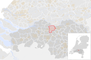
|
| 33 | Hilvarenbeek | 15.350 | 94,93 | Hilvarenbeek | 
|
| 34 | Laarbeek | 22.206 | 55,37 | Beek en Donk | 
|
| 35 | Landerd | 15.440 | 70,38 | Schaijk en Zeeland | 
|
| 36 | Loon op Zand | 23.191 | 50,15 | Kaatsheuvel | 
|
| 37 | Meierijstad | 80.500 | 184,10 | Veghel | |
| 38 | Mill en Sint Hubert | 10.821 | 52,28 | Mill | 
|
| 39 | Moerdijk | 36.933 | 159,24 | Zevenbergen | 
|
| 40 | Nuenen, Gerwen en Nederwetten | 23.060 | 33,72 | Nuenen | 
|
| 41 | Oirschot | 18.580 | 101,78 | Oirschot | 
|
| 42 | Oisterwijk | 26.162 | 63,93 | Oisterwijk | 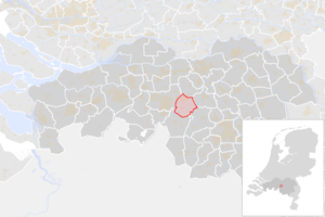
|
| 43 | Oosterhout | 55.286 | 71,47 | Oosterhout | 
|
| 44 | Oss | 91.057 | 152,42 | Oss | 
|
| 45 | Reusel-De Mierden | 13.011 | 77,93 | Reusel | 
|
| 46 | Roosendaal | 76.964 | 106,42 | Roosendaal | 
|
| 47 | Rucphen | 22.475 | 64,41 | Rucphen | 
|
| 48 | Sint Anthonis | 11.585 | 99,26 | Sint Anthonis | 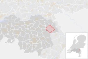
|
| 49 | Sint-Michielsgestel | 28.781 | 58,44 | Sint-Michielsgestel | 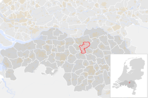
|
| 50 | Someren | 19.227 | 80,30 | Someren | 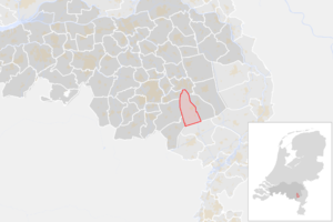
|
| 51 | Son en Breugel | 16.739 | 25,95 | Son | 
|
| 52 | Steenbergen | 25.387 | 146,66 | Steenbergen | 
|
| 53 | Tilburg | 215.946 | 117,29 | Tilburg | 
|
| 54 | Uden | 41.748 | 67,05 | Uden | 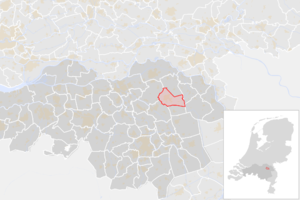
|
| 55 | Valkenswaard | 30.745 | 55,01 | Valkenswaard | 
|
| 56 | Veldhoven | 44.984 | 31,73 | Veldhoven | 
|
| 57 | Vught | 26.413 | 33,48 | Vught | 
|
| 58 | Waalre | 17.125 | 22,40 | Waalre-dorp | 
|
| 59 | Waalwijk | 47.892 | 64,59 | Waalwijk | 
|
| 60 | Woensdrecht | 21.856 | 91,55 | Hoogerheide | 
|
| 61 | Zundert | 21.765 | 120,78 | Zundert | 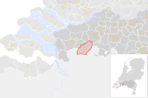
|
| Gemeenten in Nederland | |||
|---|---|---|---|
| Drenthe - Flevoland - Friesland - Gelderland - Groningen - Limburg - Noord-Brabant - Noord-Holland - Overijssel - Utrecht - Zeeland - Zuid-Holland | |||