Lijst van gemeenten in Noord-Holland: verschil tussen versies
Naar navigatie springen
Naar zoeken springen
| Regel 113: | Regel 113: | ||
| [[Bussum]] |
| [[Bussum]] |
||
| [[File:NL_-_locator_map_municipality_code_GM1942_(2016).png|300px]] |
| [[File:NL_-_locator_map_municipality_code_GM1942_(2016).png|300px]] |
||
| + | |- |
||
| + | | 16 |
||
| + | | [[Haarlem]] |
||
| + | | 158.305 |
||
| + | | 29,22 km² |
||
| + | | [[Haarlem]] |
||
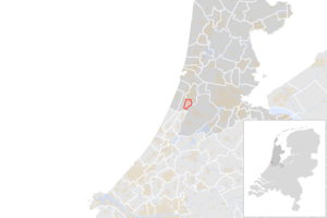
| + | | [[File:NL_-_locator_map_municipality_code_GM0392_(2016).png|300px]] |
||
| + | |- |
||
| + | | 17 |
||
| + | | [[Haarlemmerliede en Spaarnwoude]] |
||
| + | | 5.588 |
||
| + | | 19,24 km² |
||
| + | | geen (stadhuis in [[Halfweg (Haarlemmerliede en Spaarwoude)|Halfweg]]) |
||
| + | | [[File:NL_-_locator_map_municipality_code_GM0393_(2016).png|300px]] |
||
| + | |- |
||
| + | | 18 |
||
| + | | [[Haarlemmermeer]] |
||
| + | | 144.908 |
||
| + | | 178,66 km² |
||
| + | | [[Hoofddorp]] |
||
| + | | [[File:NL_-_locator_map_municipality_code_GM0394_(2016).png|300px]] |
||
| + | |- |
||
| + | | 19 |
||
| + | | [[Heemskerk]] |
||
| + | | 39.303 |
||
| + | | 27,26 km² |
||
| + | | [[Heemskerk]] |
||
| + | | [[File:NL_-_locator_map_municipality_code_GM0396_(2016).png|300px]] |
||
| + | |- |
||
| + | | 20 |
||
| + | | [[Heemstede (Noord-Holland)|Heemstede]] |
||
| + | | 26.761 |
||
| + | | 9,21 km² |
||
| + | | [[Heemstede (Noord-Holland)|Heemstede]] |
||
| + | | [[File:NL_-_locator_map_municipality_code_GM0397_(2016).png|300px]] |
||
| + | |- |
||
| + | | 21 |
||
| + | | [[Heerhugowaard]] |
||
| + | | 54.176 |
||
| + | | 38,40 km² |
||
| + | | [[Heerhugowaard]] |
||
| + | | [[File:NL_-_locator_map_municipality_code_GM0398_(2016).png|300px]] |
||
| + | |- |
||
| + | | 22 |
||
| + | | [[Heiloo]] |
||
| + | | 22.623 |
||
| + | | 18,71 km² |
||
| + | | [[Heiloo]] |
||
| + | | [[File:NL_-_locator_map_municipality_code_GM0399_(2016).png|300px]] |
||
| + | |- |
||
| + | | 23 |
||
| + | | [[Den Helder]] |
||
| + | | 56.308 |
||
| + | | 45,25 km² |
||
| + | | [[Den Helder]] |
||
| + | | [[File:NL_-_locator_map_municipality_code_GM0400_(2016).png|300px]] |
||
|- |
|- |
||
|} |
|} |
||
Versie van 17 aug 2016 18:28
| Werk in uitvoering! Aan dit artikel wordt de komende uren of dagen nog gewerkt. Belangrijk: Laat dit sjabloon niet langer staan dan nodig is, anders ontmoedig je anderen om het artikel te verbeteren. De maximale houdbaarheid van dit sjabloon is twee weken na de laatste bewerking aan het artikel. Kijk in de geschiedenis of je het artikel kunt bewerken zonder een bewerkingsconflict te veroorzaken. |
| Dit artikel is nog niet af. |
Hieronder is een lijst te vinden met alle gemeenten in de Nederlandse provincie Noord-Holland. De naam, het inwonersaantal, de oppervlakte, de hoofdplaats en een kaartje zijn weergeven. De inwonersaantallen zijn voor het laatst in 2016 bijgewerkt.
| # | Naam | Inwoners | Oppervlakte | Hoofdplaats | Kaart |
|---|---|---|---|---|---|
| 1 | Aalsmeer | 31.324 | 20,44 km² | Aalsmeer | 
|
| 2 | Alkmaar | 107.822 | 29,26 km² | Alkmaar | 
|
| 3 | Amstelveen | 88.723 | 41,45 km² | Amstelveen | 
|
| 4 | Amsterdam | 838.338 | 165,76 km² | Amsterdam | 
|
| 5 | Beemster | 8.960 | 70,58 km² | Middenbeemster | 
|
| 6 | Bergen (NH.) | 29.907 | 97,10 km² | geen (stadhuis in Alkmaar) | 
|
| 7 | Beverwijk | 40.368 | 18,34 km² | Beverwijk | 
|
| 8 | Blaricum | 9.761 | 11,11 km² | Blaricum | 
|
| 9 | Bloemendaal | 22.339 | 39,73 km² | Overveen | 
|
| 10 | Castricum | 34.741 | 49,67 km² | Castricum | 
|
| 11 | Diemen | 26.975 | 11,99 km² | Diemen | 
|
| 12 | Drechterland | 19.388 | 59,10 km² | Hoogkarspel | 
|
| 13 | Edam-Volendam | 35.483 | 16,31 km² | Volendam | 
|
| 14 | Enkhuizen | 18.441 | 12,42 km² | Enkhuizen | 
|
| 15 | Gooise Meren | 56.838 | 73,5 km² | Bussum | 
|
| 16 | Haarlem | 158.305 | 29,22 km² | Haarlem | 
|
| 17 | Haarlemmerliede en Spaarnwoude | 5.588 | 19,24 km² | geen (stadhuis in Halfweg) | 
|
| 18 | Haarlemmermeer | 144.908 | 178,66 km² | Hoofddorp | 
|
| 19 | Heemskerk | 39.303 | 27,26 km² | Heemskerk | 
|
| 20 | Heemstede | 26.761 | 9,21 km² | Heemstede | 
|
| 21 | Heerhugowaard | 54.176 | 38,40 km² | Heerhugowaard | 
|
| 22 | Heiloo | 22.623 | 18,71 km² | Heiloo | 
|
| 23 | Den Helder | 56.308 | 45,25 km² | Den Helder | 
|