Lijst van gemeenten in Gelderland: verschil tussen versies
Naar navigatie springen
Naar zoeken springen
(Aangepast) |
(De nieuwste CBS-cijfers) |
||
| (13 tussenliggende versies door 4 gebruikers niet weergegeven) | |||
| Regel 1: | Regel 1: | ||
| − | Hieronder vindt je een lijst van alle gemeenten in de [[Nederland]]se provincie [[Gelderland]]. Hierbij staan de naam, ligging (kaartje) en inwonersaantal vermeld. | + | Hieronder vindt je een '''lijst van alle gemeenten in de [[Nederland]]se provincie [[Gelderland]]'''. Hierbij staan de naam, ligging (kaartje) en inwonersaantal vermeld. Het inwonersaantal is voor het laatst in 2022 bijgewerkt. |
{| class="wikitable" | {| class="wikitable" | ||
! # | ! # | ||
! Naam | ! Naam | ||
! Inwoners | ! Inwoners | ||
| + | ! Oppervlakte | ||
| + | ! Hoofdplaats | ||
! Kaart | ! Kaart | ||
|- | |- | ||
| 1 | | 1 | ||
| [[Aalten]] | | [[Aalten]] | ||
| − | | 27. | + | | 27.105 |
| − | | [[Bestand: | + | | 96,51 km² |
| + | | [[Aalten]] | ||
| + | | [[Bestand:NL_-_locator_map_municipality_code_GM0197_(2016).png|300px]] | ||
|- | |- | ||
| 2 | | 2 | ||
| [[Apeldoorn]] | | [[Apeldoorn]] | ||
| − | | | + | | 165.648 |
| − | | [[Bestand: | + | | 339,91 km² |
| + | | [[Apeldoorn]] | ||
| + | | [[Bestand:NL_-_locator_map_municipality_code_GM0200_(2016).png|300px]] | ||
|- | |- | ||
| 3 | | 3 | ||
| [[Arnhem]] | | [[Arnhem]] | ||
| − | | | + | | 164.096 |
| − | | [[Bestand: | + | | 97,99 km² |
| + | | [[Arnhem]] | ||
| + | | [[Bestand:NL_-_locator_map_municipality_code_GM0202_(2016).png|300px]] | ||
|- | |- | ||
| 4 | | 4 | ||
| [[Barneveld (dorp)|Barneveld]] | | [[Barneveld (dorp)|Barneveld]] | ||
| − | | | + | | 60.617 |
| − | | [[Bestand: | + | | 175,96 km² |
| + | | [[Barneveld (dorp)|Barneveld]] | ||
| + | | [[Bestand:NL_-_locator_map_municipality_code_GM0203_(2016).png|300px]] | ||
|- | |- | ||
| 5 | | 5 | ||
| [[Berg en Dal]] | | [[Berg en Dal]] | ||
| − | | 34. | + | | 34.979 |
| − | | [[ | + | | 44,14 km² |
| + | | [[Groesbeek]] | ||
| + | | [[Bestand:NL_-_locator_map_municipality_code_GM1945_(2016).png|300px]] | ||
|- | |- | ||
| 6 | | 6 | ||
| [[Berkelland]] | | [[Berkelland]] | ||
| − | | | + | | 43.825 |
| − | | [[Bestand: | + | | 258,69 km² |
| + | | [[Borculo]] | ||
| + | | [[Bestand:NL_-_locator_map_municipality_code_GM1859_(2016).png|300px]] | ||
|- | |- | ||
| 7 | | 7 | ||
| [[Beuningen (Gelderland)|Beuningen]] | | [[Beuningen (Gelderland)|Beuningen]] | ||
| − | | | + | | 26.244 |
| − | | [[Bestand: | + | | 43,70 km² |
| + | | [[Beuningen (Gelderland)|Beuningen]] | ||
| + | | [[Bestand:NL_-_locator_map_municipality_code_GM0209_(2016).png|300px]] | ||
|- | |- | ||
| 8 | | 8 | ||
| [[Bronckhorst]] | | [[Bronckhorst]] | ||
| − | | 36. | + | | 36.073 |
| − | | [[Bestand: | + | | 283,56 km² |
| + | | [[Hengelo (Gelderland)|Hengelo]] | ||
| + | | [[Bestand:NL_-_locator_map_municipality_code_GM1876_(2016).png|300px]] | ||
|- | |- | ||
| 9 | | 9 | ||
| [[Brummen]] | | [[Brummen]] | ||
| − | | | + | | 20.873 |
| − | | [[Bestand: | + | | 83,97 km² |
| + | | [[Brummen]] | ||
| + | | [[Bestand:NL_-_locator_map_municipality_code_GM0213_(2016).png|300px]] | ||
|- | |- | ||
| 10 | | 10 | ||
| [[Buren (Gelderland)|Buren]] | | [[Buren (Gelderland)|Buren]] | ||
| − | | 26 | + | | 27.225 |
| − | | [[Bestand: | + | | 134,26 km² |
| + | | [[Maurik]] | ||
| + | | [[Bestand:NL_-_locator_map_municipality_code_GM0214_(2016).png|300px]] | ||
|- | |- | ||
| 11 | | 11 | ||
| [[Culemborg]] | | [[Culemborg]] | ||
| − | | | + | | 29.348 |
| − | | [[Bestand: | + | | 29,42 km² |
| + | | [[Culemborg]] | ||
| + | | [[Bestand:NL_-_locator_map_municipality_code_GM0216_(2016).png|300px]] | ||
|- | |- | ||
| 12 | | 12 | ||
| [[Doesburg]] | | [[Doesburg]] | ||
| − | | 11. | + | | 11.039 |
| − | | [[Bestand: | + | | 11,57 km² |
| + | | [[Doesburg]] | ||
| + | | [[Bestand:NL_-_locator_map_municipality_code_GM0221_(2016).png|300px]] | ||
|- | |- | ||
| 13 | | 13 | ||
| [[Doetinchem]] | | [[Doetinchem]] | ||
| − | | | + | | 58.552 |
| − | | [[Bestand: | + | | 79,06 km² |
| + | | [[Doetinchem]] | ||
| + | | [[Bestand:NL_-_locator_map_municipality_code_GM0222_(2016).png|300px]] | ||
|- | |- | ||
| 14 | | 14 | ||
| [[Druten]] | | [[Druten]] | ||
| − | | | + | | 19.209 |
| − | | [[Bestand: | + | | 37,71 km² |
| + | | [[Druten]] | ||
| + | | [[Bestand:NL_-_locator_map_municipality_code_GM0225_(2016).png|300px]] | ||
|- | |- | ||
| 15 | | 15 | ||
| [[Duiven (plaats)|Duiven]] | | [[Duiven (plaats)|Duiven]] | ||
| − | | | + | | 24.958 |
| − | | [[Bestand: | + | | 33,92 km² |
| + | | [[Duiven (plaats)|Duiven]] | ||
| + | | [[Bestand:NL_-_locator_map_municipality_code_GM0226_(2016).png|300px]] | ||
|- | |- | ||
| 16 | | 16 | ||
| [[Ede (stad)|Ede]] | | [[Ede (stad)|Ede]] | ||
| − | | | + | | 120.037 |
| − | | [[Bestand: | + | | 318,25 km² |
| + | | [[Ede (stad)|Ede]] | ||
| + | | [[Bestand:NL_-_locator_map_municipality_code_GM0228_(2016).png|300px]] | ||
|- | |- | ||
| 17 | | 17 | ||
| [[Elburg]] | | [[Elburg]] | ||
| − | | | + | | 23.746 |
| − | | [[Bestand: | + | | 63,82 km² |
| + | | [[Elburg]] | ||
| + | | [[Bestand:NL_-_locator_map_municipality_code_GM0230_(2016).png|300px]] | ||
|- | |- | ||
| 18 | | 18 | ||
| [[Epe (Gelderland)|Epe]] | | [[Epe (Gelderland)|Epe]] | ||
| − | | | + | | 33.246 |
| − | | [[Bestand: | + | | 156,29 km² |
| + | | [[Epe (Gelderland)|Epe]] | ||
| + | | [[Bestand:NL_-_locator_map_municipality_code_GM0232_(2016).png|300px]] | ||
|- | |- | ||
| 19 | | 19 | ||
| − | | [[Ermelo]] | + | | [[Ermelo (Nederland)|Ermelo]] |
| − | | | + | | 27.270 |
| − | | [[Bestand: | + | | 85,62 km² |
| + | | [[Ermelo (Nederland)|Ermelo]] | ||
| + | | [[Bestand:NL_-_locator_map_municipality_code_GM0233_(2016).png|300px]] | ||
|- | |- | ||
| 20 | | 20 | ||
| − | | [[ | + | | [[Harderwijk (Gelderland)|Harderwijk]] |
| − | | | + | | 48.839 |
| − | | [[Bestand: | + | | 38,59 km² |
| + | | [[Harderwijk (Gelderland)|Harderwijk]] | ||
| + | | [[Bestand:NL_-_locator_map_municipality_code_GM0243_(2016).png|300px]] | ||
|- | |- | ||
| 21 | | 21 | ||
| − | | [[ | + | | [[Hattem]] |
| − | | | + | | 12.304 |
| − | | [[Bestand: | + | | 23,11 km² |
| + | | [[Hattem]] | ||
| + | | [[Bestand:NL_-_locator_map_municipality_code_GM0244_(2016).png|300px]] | ||
|- | |- | ||
| 22 | | 22 | ||
| − | | [[ | + | | [[Heerde]] |
| − | | | + | | 19.010 |
| − | | [[Bestand: | + | | 78,75 km² |
| + | | [[Heerde]] | ||
| + | | [[Bestand:NL_-_locator_map_municipality_code_GM0246_(2016).png|300px]] | ||
|- | |- | ||
| 23 | | 23 | ||
| − | | [[ | + | | [[Heumen]] |
| − | | | + | | 17.021 |
| − | | [[Bestand: | + | | 39,85 km² |
| + | | [[Malden (Nederland)|Malden]] | ||
| + | | [[Bestand:NL_-_locator_map_municipality_code_GM0252_(2016).png|300px]] | ||
|- | |- | ||
| 24 | | 24 | ||
| − | | [[ | + | | [[Lingewaard]] |
| − | | | + | | 46.988 |
| − | | [[Bestand: | + | | 62,23 km² |
| + | | [[Bemmel]] | ||
| + | | [[Bestand:NL_-_locator_map_municipality_code_GM1705_(2016).png|300px]] | ||
|- | |- | ||
| 25 | | 25 | ||
| − | | [[ | + | | [[Lochem]] |
| − | | | + | | 34.096 |
| − | | [[Bestand: | + | | 213,20 km² |
| + | | [[Lochem]] | ||
| + | | [[Bestand:NL_-_locator_map_municipality_code_GM0262_(2016).png|300px]] | ||
|- | |- | ||
| 26 | | 26 | ||
| − | | [[ | + | | [[Maasdriel]] |
| − | | | + | | 25.531 |
| − | | [[Bestand: | + | | 66,02 km² |
| + | | [[Kerkdriel]] | ||
| + | | [[Bestand:NL_-_locator_map_municipality_code_GM0263_(2016).png|300px]] | ||
|- | |- | ||
| 27 | | 27 | ||
| − | | [[ | + | | [[Montferland (gemeente)|Montferland]] |
| − | | | + | | 36.348 |
| − | | [[Bestand: | + | | 105,68 km² |
| + | | [[Didam]] | ||
| + | | [[Bestand:NL_-_locator_map_municipality_code_GM1955_(2016).png|300px]] | ||
|- | |- | ||
| 28 | | 28 | ||
| − | | [[ | + | | [[Neder-Betuwe (gemeente)|Neder-Betuwe]] |
| − | | | + | | 25.061 |
| − | | [[Bestand: | + | | 60,64 km² |
| + | | [[Opheusden]] | ||
| + | | [[Bestand:NL_-_locator_map_municipality_code_GM1740_(2016).png|300px]] | ||
|- | |- | ||
| 29 | | 29 | ||
| − | | [[ | + | | [[Nijkerk]] |
| − | | | + | | 44.360 |
| − | | [[Bestand: | + | | 69,48 km² |
| + | | [[Nijkerk]] | ||
| + | | [[Bestand:NL_-_locator_map_municipality_code_GM0267_(2016).png|300px]] | ||
|- | |- | ||
| 30 | | 30 | ||
| − | | [[ | + | | [[Nijmegen]] |
| − | | | + | | 179.073 |
| − | | [[Bestand: | + | | 53,62 km² |
| + | | [[Nijmegen]] | ||
| + | | [[Bestand:NL_-_locator_map_municipality_code_GM0268_(2016).png|300px]] | ||
|- | |- | ||
| 31 | | 31 | ||
| − | | [[ | + | | [[Nunspeet]] |
| − | | | + | | 28.209 |
| − | | [[Bestand: | + | | 128,79 km² |
| + | | [[Nunspeet]] | ||
| + | | [[Bestand:NL_-_locator_map_municipality_code_GM0302_(2016).png|300px]] | ||
|- | |- | ||
| 32 | | 32 | ||
| − | | [[ | + | | [[Oldebroek]] |
| − | | | + | | 23.933 |
| − | | [[Bestand: | + | | 97,68 km² |
| + | | [[Oldebroek]] | ||
| + | | [[Bestand:NL_-_locator_map_municipality_code_GM0269_(2016).png|300px]] | ||
|- | |- | ||
| 33 | | 33 | ||
| − | | [[ | + | | [[Oost Gelre]] |
| − | | | + | | 29.622 |
| − | | [[Bestand: | + | | 109,67 km² |
| + | | [[Lichtenvoorde]] en [[Groenlo]] | ||
| + | | [[Bestand:NL_-_locator_map_municipality_code_GM1586_(2016).png|300px]] | ||
|- | |- | ||
| 34 | | 34 | ||
| − | | [[ | + | | [[Oude IJsselstreek]] |
| − | | | + | | 39.365 |
| − | | [[Bestand: | + | | 136,40 km² |
| + | | [[Gendringen]] | ||
| + | | [[Bestand:NL_-_locator_map_municipality_code_GM1509_(2016).png|300px]] | ||
|- | |- | ||
| 35 | | 35 | ||
| − | | [[ | + | | [[Overbetuwe]] |
| − | | | + | | 48.274 |
| − | | [[Bestand: | + | | 109,36 km² |
| + | | [[Elst (Gelderland)|Elst]] | ||
| + | | [[Bestand:NL_-_locator_map_municipality_code_GM1734_(2016).png|300px]] | ||
|- | |- | ||
| 36 | | 36 | ||
| − | | [[ | + | | [[Putten (Gelderland)|Putten]] |
| − | | | + | | 24.602 |
| − | | [[Bestand: | + | | 85,12 km² |
| + | | [[Putten (Gelderland)|Putten]] | ||
| + | | [[Bestand:NL_-_locator_map_municipality_code_GM0273_(2016).png|300px]] | ||
|- | |- | ||
| 37 | | 37 | ||
| − | | [[ | + | | [[Renkum]] |
| − | | | + | | 31.322 |
| − | | [[Bestand: | + | | 46,01 km² |
| + | | [[Oosterbeek]] | ||
| + | | [[Bestand:NL_-_locator_map_municipality_code_GM0274_(2016).png|300px]] | ||
|- | |- | ||
| 38 | | 38 | ||
| − | | [[ | + | | [[Rheden]] |
| − | | | + | | 43.476 |
| − | | [[Bestand: | + | | 81,76 km² |
| + | | [[De Steeg (Gelderland)|De Steeg]] | ||
| + | | [[Bestand:NL_-_locator_map_municipality_code_GM0275_(2016).png|300px]] | ||
|- | |- | ||
| 39 | | 39 | ||
| − | | [[ | + | | [[Rozendaal]] |
| − | | | + | | 1.753 |
| − | | [[Bestand: | + | | 27,90 km² |
| + | | [[Rozendaal]] | ||
| + | | [[Bestand:NL_-_locator_map_municipality_code_GM0277_(2016).png|300px]] | ||
|- | |- | ||
| 40 | | 40 | ||
| − | | [[ | + | | [[Scherpenzeel (gemeente)|Scherpenzeel]] |
| − | | | + | | 10.308 |
| − | | [[Bestand: | + | | 13,79 km² |
| + | | [[Scherpenzeel (Gelderland)|Scherpenzeel]] | ||
| + | | [[Bestand:NL_-_locator_map_municipality_code_GM0279_(2016).png|300px]] | ||
|- | |- | ||
| 41 | | 41 | ||
| − | | [[ | + | | [[Tiel]] |
| − | | | + | | 42.291 |
| − | | [[Bestand: | + | | 32,27 km² |
| + | | [[Tiel]] | ||
| + | | [[Bestand:NL_-_locator_map_municipality_code_GM0281_(2016).png|300px]] | ||
|- | |- | ||
| 42 | | 42 | ||
| − | | [[ | + | | [[Voorst (gemeente)|Voorst]] |
| − | | | + | | 24.991 |
| − | | [[Bestand: | + | | 123,07 km² |
| + | | [[Twello]] | ||
| + | | [[Bestand:NL_-_locator_map_municipality_code_GM0285_(2016).png|300px]] | ||
|- | |- | ||
| 43 | | 43 | ||
| − | | [[ | + | | [[Wageningen (Nederland)|Wageningen]] |
| − | | | + | | 39.923 |
| − | | [[Bestand: | + | | 30,49 km² |
| + | | [[Wageningen (Nederland)|Wageningen]] | ||
| + | | [[Bestand:NL_-_locator_map_municipality_code_GM0289_(2016).png|300px]] | ||
|- | |- | ||
| 44 | | 44 | ||
| − | | [[ | + | | [[West Betuwe]] |
| − | | | + | | 52.010 |
| − | | [[Bestand:Map_-_NL_- | + | | 229,12 km² |
| + | | [[Geldermalsen]] | ||
| + | | [[Bestand:Map_-_NL_-_Municipality_code_1960_(2019).svg|300px]] | ||
|- | |- | ||
| 45 | | 45 | ||
| − | | [[ | + | | [[West Maas en Waal]] |
| − | | | + | | 19.674 |
| − | | [[Bestand: | + | | 77,40 km² |
| + | | [[Beneden-Leeuwen]] | ||
| + | | [[Bestand:NL_-_locator_map_municipality_code_GM0668_(2016).png|300px]] | ||
|- | |- | ||
| 46 | | 46 | ||
| − | | [[ | + | | [[Westervoort]] |
| − | | | + | | 14.943 |
| − | | [[Bestand: | + | | 7,05 km² |
| + | | [[Westervoort]] | ||
| + | | [[Bestand:NL_-_locator_map_municipality_code_GM0293_(2016).png|300px]] | ||
|- | |- | ||
| 47 | | 47 | ||
| − | | [[ | + | | [[Wijchen]] |
| − | | | + | | 41.319 |
| − | | [[Bestand: | + | | 66,49 km² |
| + | | [[Wijchen]] | ||
| + | | [[Bestand:NL_-_locator_map_municipality_code_GM0296_(2016).png|300px]] | ||
|- | |- | ||
| 48 | | 48 | ||
| − | | [[ | + | | [[Winterswijk]] |
| − | | | + | | 29.166 |
| − | | [[Bestand: | + | | 138,15 km² |
| + | | [[Winterswijk]] | ||
| + | | [[Bestand:NL_-_locator_map_municipality_code_GM0294_(2016).png|300px]] | ||
|- | |- | ||
| 49 | | 49 | ||
| − | | [[ | + | | [[Zaltbommel]] |
| − | | | + | | 29.982 |
| − | | [[Bestand: | + | | 79,61 km² |
| + | | [[Zaltbommel]] | ||
| + | | [[Bestand:NL_-_locator_map_municipality_code_GM0297_(2016).png|300px]] | ||
|- | |- | ||
| 50 | | 50 | ||
| − | | [[ | + | | [[Zevenaar]] |
| − | | | + | | 44.689 |
| − | | [[Bestand: | + | | 53,26 km² |
| + | | [[Zevenaar]] | ||
| + | | [[Bestand:NL_-_locator_map_municipality_code_GM0299_(2016).png|300px]] | ||
|- | |- | ||
| 51 | | 51 | ||
| − | |||
| − | |||
| − | |||
| − | |||
| − | |||
| − | |||
| − | |||
| − | |||
| − | |||
| − | |||
| − | |||
| − | |||
| − | |||
| − | |||
| − | |||
| [[Zutphen]] | | [[Zutphen]] | ||
| − | | | + | | 48.299 |
| − | | [[Bestand: | + | | 40,98 km² |
| + | | [[Zutphen]] | ||
| + | | [[Bestand:NL_-_locator_map_municipality_code_GM0301_(2016).png|300px]] | ||
|- | |- | ||
|} | |} | ||
{{Navigatie gemeentelijsten Nederland}} | {{Navigatie gemeentelijsten Nederland}} | ||
| − | [[Categorie:Lijst | + | [[Categorie:Lijst van gemeenten in Nederland|G]] |
[[Categorie:Gemeente in Gelderland| ]] | [[Categorie:Gemeente in Gelderland| ]] | ||
Huidige versie van 31 dec 2022 om 21:37
Hieronder vindt je een lijst van alle gemeenten in de Nederlandse provincie Gelderland. Hierbij staan de naam, ligging (kaartje) en inwonersaantal vermeld. Het inwonersaantal is voor het laatst in 2022 bijgewerkt.
| # | Naam | Inwoners | Oppervlakte | Hoofdplaats | Kaart |
|---|---|---|---|---|---|
| 1 | Aalten | 27.105 | 96,51 km² | Aalten | 
|
| 2 | Apeldoorn | 165.648 | 339,91 km² | Apeldoorn | 
|
| 3 | Arnhem | 164.096 | 97,99 km² | Arnhem | 
|
| 4 | Barneveld | 60.617 | 175,96 km² | Barneveld | 
|
| 5 | Berg en Dal | 34.979 | 44,14 km² | Groesbeek | 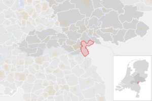
|
| 6 | Berkelland | 43.825 | 258,69 km² | Borculo | 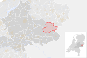
|
| 7 | Beuningen | 26.244 | 43,70 km² | Beuningen | 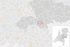
|
| 8 | Bronckhorst | 36.073 | 283,56 km² | Hengelo | 
|
| 9 | Brummen | 20.873 | 83,97 km² | Brummen | 
|
| 10 | Buren | 27.225 | 134,26 km² | Maurik | 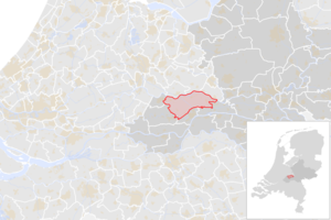
|
| 11 | Culemborg | 29.348 | 29,42 km² | Culemborg | 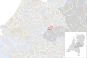
|
| 12 | Doesburg | 11.039 | 11,57 km² | Doesburg | 
|
| 13 | Doetinchem | 58.552 | 79,06 km² | Doetinchem | 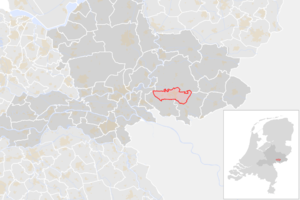
|
| 14 | Druten | 19.209 | 37,71 km² | Druten | 
|
| 15 | Duiven | 24.958 | 33,92 km² | Duiven | 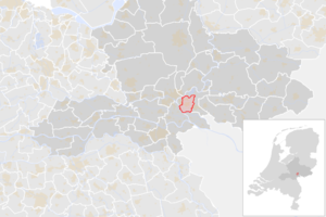
|
| 16 | Ede | 120.037 | 318,25 km² | Ede | 
|
| 17 | Elburg | 23.746 | 63,82 km² | Elburg | 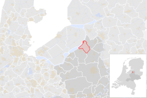
|
| 18 | Epe | 33.246 | 156,29 km² | Epe | 
|
| 19 | Ermelo | 27.270 | 85,62 km² | Ermelo | 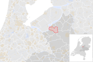
|
| 20 | Harderwijk | 48.839 | 38,59 km² | Harderwijk | 
|
| 21 | Hattem | 12.304 | 23,11 km² | Hattem | 
|
| 22 | Heerde | 19.010 | 78,75 km² | Heerde | 
|
| 23 | Heumen | 17.021 | 39,85 km² | Malden | 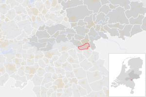
|
| 24 | Lingewaard | 46.988 | 62,23 km² | Bemmel | 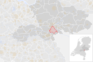
|
| 25 | Lochem | 34.096 | 213,20 km² | Lochem | 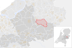
|
| 26 | Maasdriel | 25.531 | 66,02 km² | Kerkdriel | 
|
| 27 | Montferland | 36.348 | 105,68 km² | Didam | 
|
| 28 | Neder-Betuwe | 25.061 | 60,64 km² | Opheusden | 
|
| 29 | Nijkerk | 44.360 | 69,48 km² | Nijkerk | 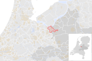
|
| 30 | Nijmegen | 179.073 | 53,62 km² | Nijmegen | 
|
| 31 | Nunspeet | 28.209 | 128,79 km² | Nunspeet | 
|
| 32 | Oldebroek | 23.933 | 97,68 km² | Oldebroek | 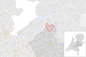
|
| 33 | Oost Gelre | 29.622 | 109,67 km² | Lichtenvoorde en Groenlo | 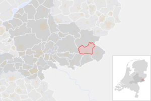
|
| 34 | Oude IJsselstreek | 39.365 | 136,40 km² | Gendringen | 
|
| 35 | Overbetuwe | 48.274 | 109,36 km² | Elst | 
|
| 36 | Putten | 24.602 | 85,12 km² | Putten | 
|
| 37 | Renkum | 31.322 | 46,01 km² | Oosterbeek | 
|
| 38 | Rheden | 43.476 | 81,76 km² | De Steeg | 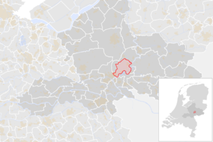
|
| 39 | Rozendaal | 1.753 | 27,90 km² | Rozendaal | 
|
| 40 | Scherpenzeel | 10.308 | 13,79 km² | Scherpenzeel | 
|
| 41 | Tiel | 42.291 | 32,27 km² | Tiel | 
|
| 42 | Voorst | 24.991 | 123,07 km² | Twello | 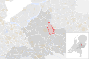
|
| 43 | Wageningen | 39.923 | 30,49 km² | Wageningen | 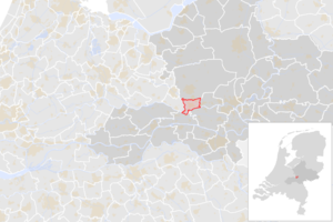
|
| 44 | West Betuwe | 52.010 | 229,12 km² | Geldermalsen | 
|
| 45 | West Maas en Waal | 19.674 | 77,40 km² | Beneden-Leeuwen | 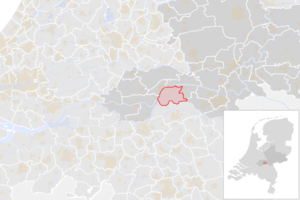
|
| 46 | Westervoort | 14.943 | 7,05 km² | Westervoort | 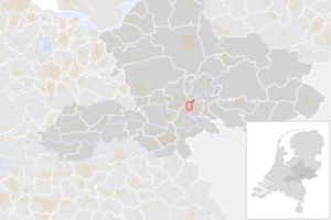
|
| 47 | Wijchen | 41.319 | 66,49 km² | Wijchen | 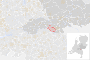
|
| 48 | Winterswijk | 29.166 | 138,15 km² | Winterswijk | 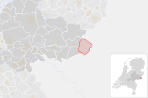
|
| 49 | Zaltbommel | 29.982 | 79,61 km² | Zaltbommel | 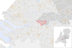
|
| 50 | Zevenaar | 44.689 | 53,26 km² | Zevenaar | 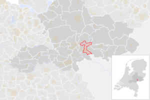
|
| 51 | Zutphen | 48.299 | 40,98 km² | Zutphen | 
|
| Gemeenten in Nederland | |||
|---|---|---|---|
| Drenthe - Flevoland - Friesland - Gelderland - Groningen - Limburg - Noord-Brabant - Noord-Holland - Overijssel - Utrecht - Zeeland - Zuid-Holland | |||