Bestand:Map spb 1744 high.jpg
Naar navigatie springen
Naar zoeken springen

Grootte van deze voorvertoning: 800 × 552 pixels. Andere resoluties: 320 × 221 pixels | 640 × 441 pixels | 1.024 × 706 pixels | 1.280 × 883 pixels | 2.100 × 1.448 pixels.
Afbeelding in hogere resolutie (2.100 × 1.448 pixels, bestandsgrootte: 741 kB, MIME-type: image/jpeg)
Beschrijving
| Beschrijving |
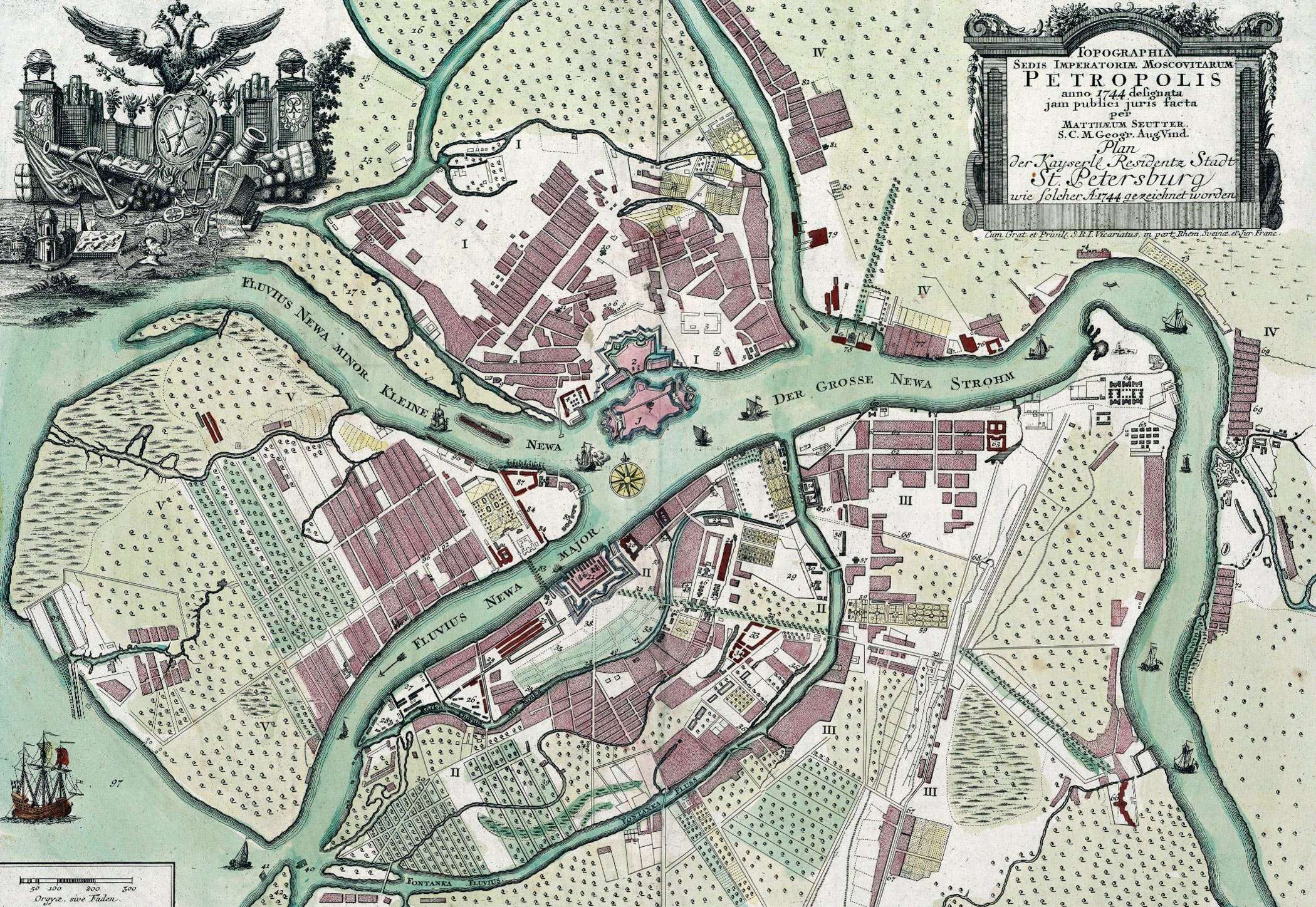
English: Map of St. Petersburg compiled, in 1744, by Matthias Souter Русский: Карта Санкт-Петербурга составленная в 1744 г. Маттиас Сойтер |
| Datum | |
| Bron | http://www.spbin.ru/maps/map_stoyter_1744.htm |
| Auteur | Маттиас Сойтер |
Licentie
|
Dit werk bevindt zich in het publiek domein in landen en gebieden waar de auteursrechttermijn het leven van de auteur plus 100 jaar of minder is. | |
| Van dit bestand is vastgesteld dat er geen bekende auteursrechtaanspraken op rusten, alle aanverwante en naburige rechten daarbij inbegrepen. | |
Bestandsgeschiedenis
Klik op een datum/tijd om het bestand te zien zoals het destijds was.
| Datum/tijd | Miniatuur | Afmetingen | Gebruiker | Opmerking | |
|---|---|---|---|---|---|
| huidige versie | 25 mei 2010 09:47 | | 2.100 × 1.448 (741 kB) | Peterburg23 | == Summary == {{Information |Description=Карта Санкт-Петербурга составленная в 1744 г. Маттиас Сойтер |Source=http://www.spbin.ru/maps/map_stoyter_1744.htm |Date=1744 |Author=Маттиас Сойтер |Perm |
Bestandsgebruik
Dit bestand wordt op de volgende pagina gebruikt: