A6 (Luxemburg)
Naar navigatie springen
Naar zoeken springen
- 006699; font-size: 11px;"
| colspan="2" style="font-size: 10pt; font-weight: bold; text-align: center; background: | |
colspan=2 style="font-size: 10pt; font-weight: bold; text-align: center; background:
| |
| Van | Luxemburg A1 |
| Naar | |
| Land | |
| Lengte | 20,1 km |
| District(en) | Luxemburg |
colspan=2 style="font-size: 10pt; font-weight: bold; text-align: center; background:
| |

| |

| |
colspan=2 style="font-size: 10pt; font-weight: bold; text-align: center; background:
| |
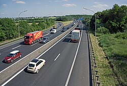
De A6 in Luxemburg of ook wel Autoroute d'Arlon genoemd, is een autosnelweg in het zuidwesten van Luxemburg. De weg loopt van Steinfort naar Croix de Gasperich. De weg is 20,1 kilomter lang.
| Autosnelwegen in Luxemburg | |||
|---|---|---|---|
| A1 · A3 · A4 ·A6 · A7 · A13 | |||

