Bestand:Nasa world wind - teneriffa.jpg

Uit Wikikids
Naar navigatie springen Naar zoeken springen
Afbeelding in hogere resolutie(1.280 × 958 pixels, bestandsgrootte: 120 kB, MIME-type: image/jpeg)

Dit bestand is afkomstig van Wikimedia Commons en kan ook in andere projecten gebruikt worden. De bestandsbeschrijvingspagina wordt hieronder weergegeven.

Beschrijving

Beschrijving
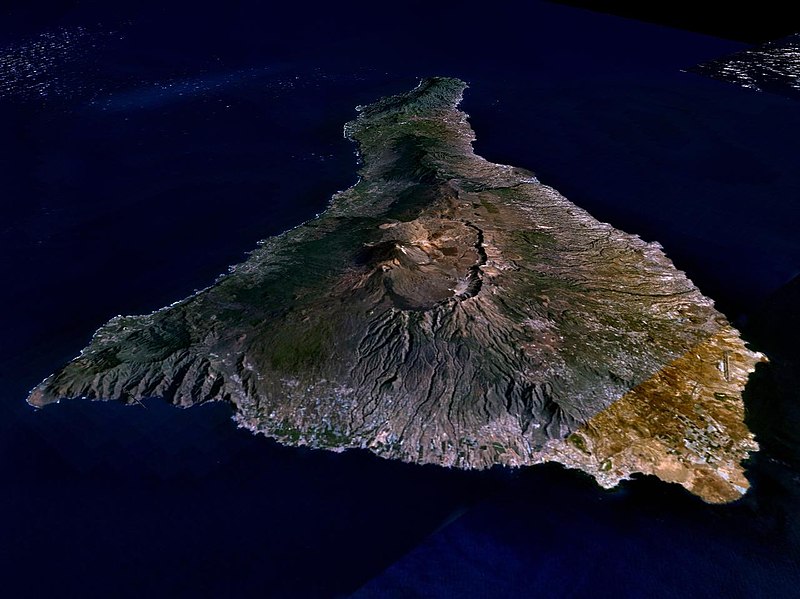
English: Teneriffa from the west side. One sees Teide (3,700 meters) and the Caldera (2,000 m). To the right hand the new airport. On the left side one sees that there is more humidity and therefore vegetation at the north side of the island.
Datum 31 maart 2005 (originele uploaddatum)
Bron NASA World Wind
Auteur NASA World Wind
Toestemming
(Hergebruik van dit bestand)
Public domain

Licentie

Public domain
Deze afbeelding bevindt zich in het publiek domein omdat het een screenshot is van NASA’s software World Wind die gebruik maakt van een publiek domein-laag, zoals Blue Marble, MODIS, Landsat, SRTM, USGS of GLOBE.

العربيَّة | English | فارسی | français | עברית | македонски | മലയാളം | Nederlands | русский | 中文(中国大陆)‎ | +/−

Bijschriften

Beschrijf in één regel wat dit bestand voorstelt

Items getoond in dit bestand

beeldt af

Bestandsgeschiedenis

Klik op een datum/tijd om het bestand te zien zoals het destijds was.

Datum/tijdMiniatuurAfmetingenGebruikerOpmerking
huidige versie31 mrt 2005 03:15Miniatuurafbeelding voor de versie van 31 mrt 2005 03:151.280 × 958 (120 kB)Simplicius{{NASA-PD}} Teneriffa from the west side. One sees Teide (3,700 meters) and the Caldera (2,000 m). To the right hand the new airport. On the left side one sees that there is more humidity and therefore vegetation at the north side of the island.

Dit bestand wordt op de volgende pagina gebruikt:

Afkomstig van Wikikids , de interactieve Nederlandstalige Internet-encyclopedie voor en door kinderen. "https://wikikids.nl/Bestand:Nasa_world_wind_-_teneriffa.jpg"