Bestand:Map of CSA 3.png
Naar navigatie springen
Naar zoeken springen

Grootte van deze voorvertoning: 800 × 405 pixels. Andere resoluties: 320 × 162 pixels | 640 × 324 pixels | 1.024 × 518 pixels | 1.800 × 911 pixels.
Afbeelding in hogere resolutie (1.800 × 911 pixels, bestandsgrootte: 947 kB, MIME-type: image/png)
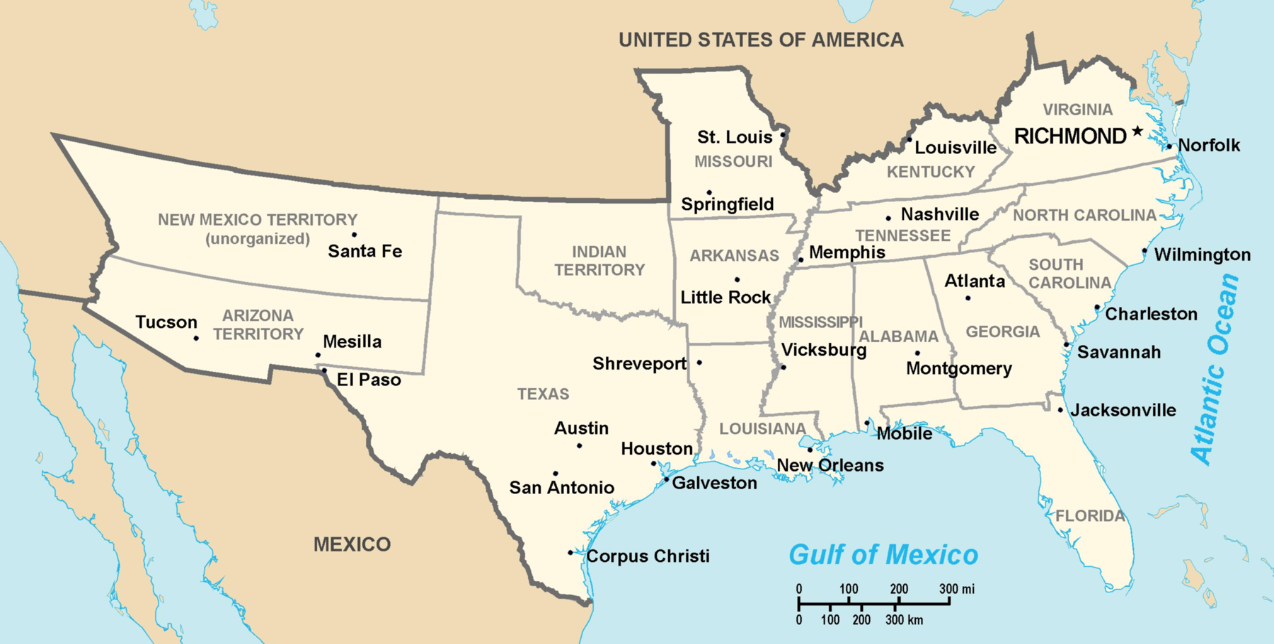
Theoretical territory map of Confederate States (much of Missouri, Kentucky, West Virginia and far western areas were never under effective Confederate control), Created by Nicholas Forte
(del) (cur) 00:53, 16 August 2005 . . Nicholas F . . 1800x911 (969382 bytes) (Created by Nicholas Forte )
Deze afbeelding bevindt zich in het publiek domein omdat het materiaal bevat dat oorspronkelijk afkomstig is van het CIA World Factbook.
|
 |
derivative works
Afgeleide werken van dit bestand: Map of CSA - Georgia highlighted.png
Bestandsgeschiedenis
Klik op een datum/tijd om het bestand te zien zoals het destijds was.
| Datum/tijd | Miniatuur | Afmetingen | Gebruiker | Opmerking | |
|---|---|---|---|---|---|
| huidige versie | 7 dec 2005 20:20 | | 1.800 × 911 (947 kB) | Walden69 | Map of Confederate States Created by Nicholas Forte This image has been released into the public domain by the copyright holder, its copyright has expired, or it is ineligible for copyright. This applies worldwide. Subject to disclaimers. File history L |
Bestandsgebruik
Dit bestand wordt op de volgende pagina gebruikt: