Bestand:Great salt lake drainage map.jpg
Naar navigatie springen
Naar zoeken springen


Grootte van deze voorvertoning: 518 × 600 pixels. Andere resoluties: 207 × 240 pixels | 415 × 480 pixels | 663 × 768 pixels | 1.060 × 1.227 pixels.
Afbeelding in hogere resolutie (1.060 × 1.227 pixels, bestandsgrootte: 1,13 MB, MIME-type: image/jpeg)
Beschrijving
| Beschrijving |
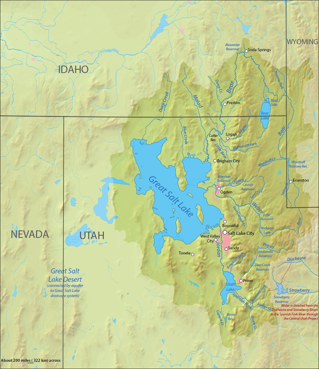
English: Map of the Great Salt Lake drainage area |
| Datum | |
| Bron | Topography from DEMIS Mapserver modifications all made myself with Adobe Illustrator and Photoshop |
| Auteur | Shannon1 |
Licentie
Ik, de auteursrechthebbende van dit werk, maak het hierbij onder de volgende licenties beschikbaar:

|
Toestemming wordt verleend voor het kopiëren, verspreiden en/of wijzigen van dit document onder de voorwaarden van de GNU-licentie voor vrije documentatie, versie 1.2 of enige latere versie als gepubliceerd door de Free Software Foundation; zonder Invariant Sections, zonder Front-Cover Texts, en zonder Back-Cover Texts. Een kopie van de licentie is opgenomen in de sectie GNU-licentie voor vrije documentatie. |
This file is licensed under the Creative Commons Attribution-Share Alike 4.0 International, 3.0 Unported, 2.5 Generic, 2.0 Generic and 1.0 Generic license.
- De gebruiker mag:
- Delen – het werk kopiëren, verspreiden en doorgeven
- Remixen – afgeleide werken maken
- Onder de volgende voorwaarden:
- naamsvermelding – U moet op een gepaste manier aan naamsvermelding doen, een link naar de licentie geven, en aangeven of er wijzigingen in het werk zijn aangebracht. U mag dit op elke redelijke manier doen, maar niet zodanig dat de indruk wordt gewekt dat de licentiegever instemt met uw werk of uw gebruik van zijn werk.
- Gelijk delen – Als u het werk heeft geremixt, veranderd, of erop heeft voortgebouwd, moet u het gewijzigde materiaal verspreiden onder dezelfde licentie als het oorspronkelijke werk, of een daarmee compatibele licentie.
U mag zelf één van de licenties kiezen.
Bestandsgeschiedenis
Klik op een datum/tijd om het bestand te zien zoals het destijds was.
| Datum/tijd | Miniatuur | Afmetingen | Gebruiker | Opmerking | |
|---|---|---|---|---|---|
| huidige versie | 2 jan 2013 22:31 | | 1.060 × 1.227 (1,13 MB) | Shannon1 | {{Information |Description ={{en|1=Map of the Great Salt Lake drainage area }} |Source =Topography from [http://www2.demis.nl/mapserver/mapper.asp DEMIS Mapserver] modifications all made myself with Adobe Illustrator and Photoshop |Author ... |
Bestandsgebruik
Dit bestand wordt op de volgende pagina gebruikt: