Bestand:Map of Hawaii NA.png
Naar navigatie springen
Naar zoeken springen

Grootte van deze voorvertoning: 776 × 600 pixels. Andere resoluties: 311 × 240 pixels | 621 × 480 pixels | 994 × 768 pixels | 1.280 × 989 pixels | 2.122 × 1.640 pixels.
Afbeelding in hogere resolutie (2.122 × 1.640 pixels, bestandsgrootte: 370 kB, MIME-type: image/png)
Beschrijving
| Beschrijving |
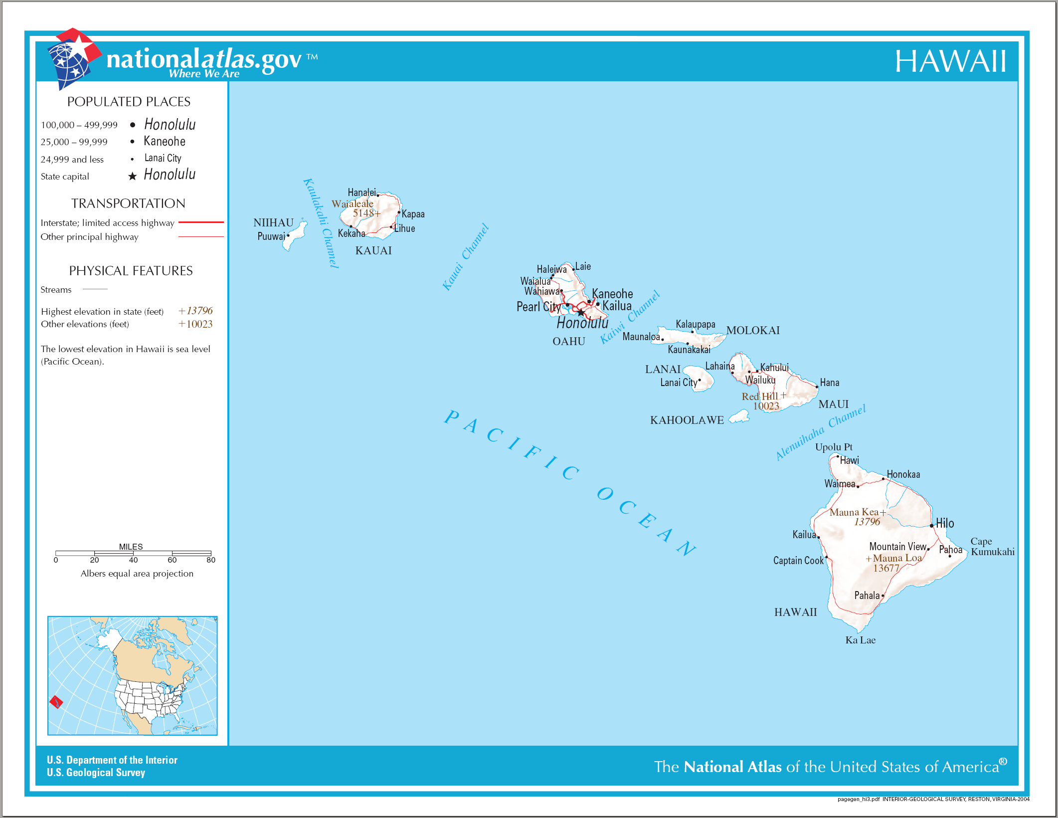
English: Reference Map of Hawaii. |
| Datum | |
| Bron | |
| Auteur | National Atlas of the United States |
| Toestemming (Hergebruik van dit bestand) |
Public domain |
Licentie
This map was obtained from an edition of the National Atlas of the United States. Like almost all works of the U.S. federal government, works from the National Atlas are in the public domain in the United States.
Online access: NationalAtlas.gov | 1970 print edition: Library of Congress, Perry-Castañeda Library
|
Bestandsgeschiedenis
Klik op een datum/tijd om het bestand te zien zoals het destijds was.
| Datum/tijd | Miniatuur | Afmetingen | Gebruiker | Opmerking | |
|---|---|---|---|---|---|
| huidige versie | 15 aug 2006 12:26 | | 2.122 × 1.640 (370 kB) | Huebi~commonswiki | {{Information| |Description=Map of Hawaii |Source=[http://www.nationalatlas.gov National Atlas] }} Category:Maps of the United States Category:Maps of Hawaii {{PD-USGov-Atlas}} |
Bestandsgebruik
Geen enkele pagina gebruikt dit bestand.