Bestand:Baton Rouge Louisiana waterfront aerial view.jpg
Naar navigatie springen
Naar zoeken springen

Grootte van deze voorvertoning: 750 × 600 pixels. Andere resoluties: 300 × 240 pixels | 600 × 480 pixels | 960 × 768 pixels | 1.280 × 1.024 pixels | 1.500 × 1.200 pixels.
Afbeelding in hogere resolutie (1.500 × 1.200 pixels, bestandsgrootte: 1,04 MB, MIME-type: image/jpeg)
| Beschrijving |
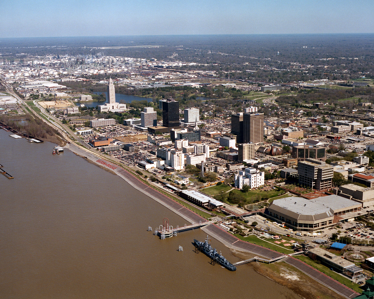
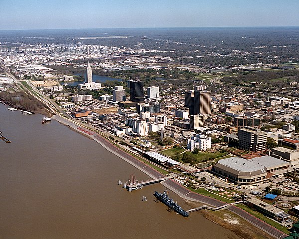
English: Aerial view of the riverfront area of Baton Rouge, Louisiana, USA. The city fronts on the Mississippi River in the center of Louisiana. The tall state capitol tower can be seen at center left. The historic destroyer USS Kidd is moored in the river at the bottom of the picture. View is to the north-northeast. |
|||
| Datum | ||||
| Bron |
U.S. Army Corps of Engineers Digital Visual Library Image page Image description page Digital Visual Library home page |
|||
| Auteur | Michael Maples, U.S. Army Corps of Engineers | |||
| Toestemming (Hergebruik van dit bestand) |
|
|||
| Locatie | Baton Rouge, Louisiana, USA |
| Cameralocatie | | Deze en andere afbeeldingen in: OpenStreetMap |
|---|
Bestandsgeschiedenis
Klik op een datum/tijd om het bestand te zien zoals het destijds was.
| Datum/tijd | Miniatuur | Afmetingen | Gebruiker | Opmerking | |
|---|---|---|---|---|---|
| huidige versie | 6 apr 2007 05:05 | | 1.500 × 1.200 (1,04 MB) | DanMS | {{Information | Description = {{en|Aerial view of the riverfront area of Baton Rouge, Louisiana, USA. The ctiy fronts on the Mississippi River in the center of Louisiana. The tall state capital tower can be seen at center left. The historic destroyer U |
Bestandsgebruik
Dit bestand wordt op de volgende pagina gebruikt: